The i-Run team says
Chart Your Course
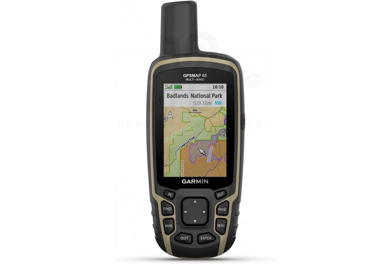
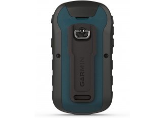
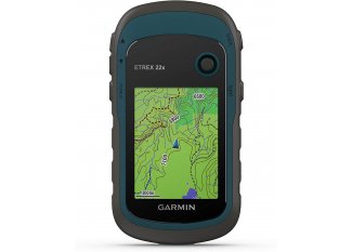
Explore the hiking trails of your choice with the Garmin GPSMAP 65 handheld GPS and never lose sight of your goal.
Enjoy precise location thanks to the support of multiple GNSS and multi-band technology. These features succeed in positioning and guiding you through the most complex terrains.
The preloaded TopoActive Europe maps provide you with a multitude of routes and paths to discover by foot or bicycle. Its 16 GB internal memory and slot for a microSD card allow you to easily add new maps.
Compatible with the Garmin Explore app, it offers you the possibility to easily manage your routes and keep an eye on your activity data. The Bluetooth pairing with your smartphone provides you with notifications such as SMS and received emails.
Particularly robust, this model resists shocks during your nature getaways while its water resistance makes it a versatile ally. Its anti-glare color screen remains readable regardless of the lighting.
Its 16-hour battery life gives you ample time to traverse your routes with peace of mind.
Key Features of the Garmin GPSMAP 65 Handheld GPS
- GPS designed for hiking
- GPS, GALILEO, QZSS, and GLONASS satellites: location and guidance even in remote and challenging environments (dense forests, urban canyons...)
- Navigation buttons: practicality
- Smart notifications
- Bluetooth® and ANT+
- Compatible with the Garmin Explore app and website
- Support for multiple frequency bands: precise location
- Information on terrain difficulty, terrain description, and tips for progress
- TopoActive Europe: preloaded maps
- Location of points of interest, natural sites, boundaries, and watercourses
- 16 GB internal memory: add new maps
- Slot for a microSD card not included: memory
- Support for geocaching GPX files
- 2.6-inch anti-glare color screen: easy reading
- Resistance to rain, humidity, and dust
- Water resistance: IPX7
- Battery life: 16 hours
- Dimensions: 6.1 x 16.0 x 3.6 cm
- Colors: black and beige
Technical description
Physical Characteristics:
- Physical dimensions: 6.1 x 16.0 x 3.6 cm
- Display size (width by height): 3.6 x 5.5 cm; 6.6 cm diagonal
- Screen resolution (width by height): 160 x 240 pixels
- Display type: 2.6-inch transflective TFT color screen, 65,000 colors
- Weight: 217 g with batteries
- Battery: 2 AA batteries (not included); NiMH or Lithium recommended
- Battery life: 16 hours
- Water resistance rating: IPX7
- High sensitivity receiver
- Interface: compatible with high-speed mini USB and NMEA 0183
- Memory: 16 GB
Main Features:
- Preloaded TopoActive Europe maps (routable on roads and trails)
- Ability to add maps
- Base map
- Automatic route generation (turn-by-turn routing function)
- Map segments: 3000
- BirdsEye: 250 BirdsEye images
- Detailed hydrographic features (coastlines, lake and river shores, swamps, and seasonal and permanent waterways)
- Points of interest with search function (parks, campsites, viewpoints, and picnic areas)
- Displays national, federal, and local parks, forests, and nature reserves
- GPS and GLONASS satellites
- Storage capacity and power: microSD card not included
- Information on terrain difficulty, terrain description, and tips for progression
- Worldwide base map
- Support for geocaching GPX files
- Base map
- Waypoints: 5000
- Tracks: 200
- Track log: 10,000 points, 200 saved tracks
- Routes: 200, 250 points per route; 50 automatic route generation points
- Point-to-point navigation
- Compatible with Basecamp
- Area calculation
- Hunting and fishing calendar
- Sun and moon information
- Geocaching mode
- Compatible with Custom MAPS: 500 customized map zones
- JPEG viewer
- Smart Notifications on the portable device
- VIRB remote control
- Compatible with Garmin Connect™ Mobile
- Compatible with Garmin Explore™ for waypoints, tracks, routes, and activities
- Compatible with Garmin Explore website
- Wireless connectivity: Bluetooth and ANT+
Sensors:
- GPS
- GLONASS
- GALILEO
- QZSS
- Multi-frequency band support
- GPS compass (in motion)
Technologies
-
Ant+
Wireless technology enabling the automatic transfer of data to the computer when it is within range of the watch.
-
Garmin Connect
Garmin Connect is an online community where athletes can connect and compete by participating in challenges, encouraging each other, and sharing their performances via social networks. Garmin Connect is free and available on your smartphone with the Garmin Connect Mobile app.
